Oct 25, 2022
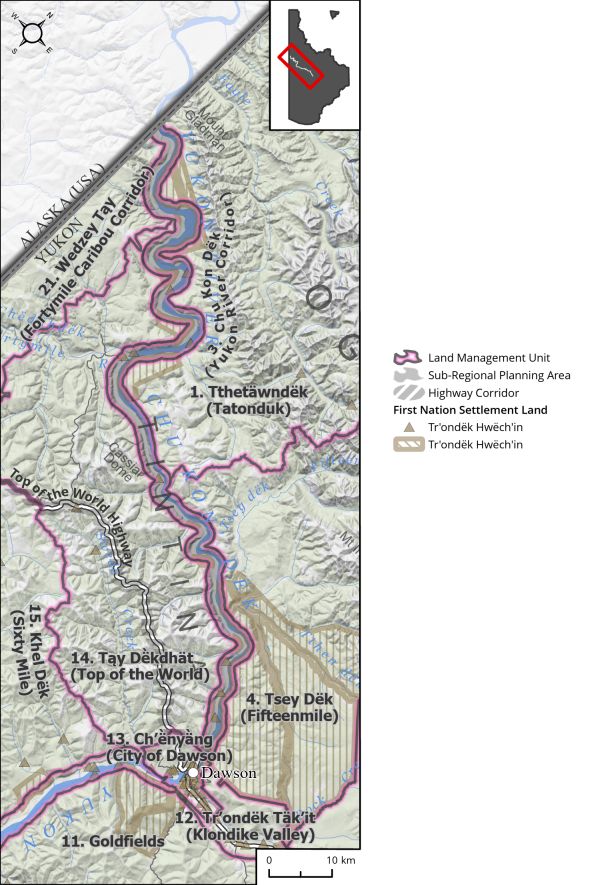
Land Use Designation: Sub-regional Planning Area Land Status: Non-Settlement Land and Settlement Land, including 52 Tr’ondëk Hwëch’in Settlement Land Parcels Area: 926 km2 Planning Region % 2.3% Walking on the Land Together (Intent Statement) The vision for this...
Oct 25, 2022
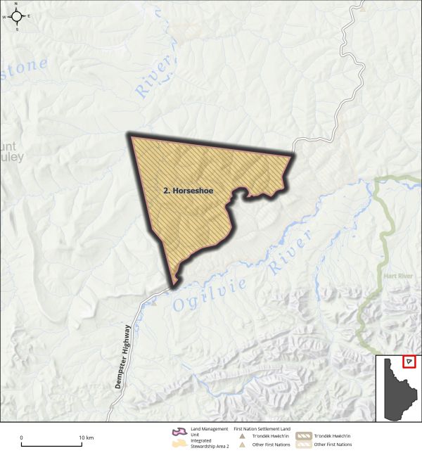
Land Use Designation: Integrated Stewardship Area 2 Land Status: Tr’ondëk Hwëch’in Settlement Land R-49A Area: 329 km2 Planning Region % 0.8% Walking on the Land Together (Intent Statement) The vision for this area is to ensure habitat requirements for the Porcupine...
Oct 24, 2022
This page is under construction. For more information on this LMU, see one of our versions of the Recommended Plan. Come back in the coming weeks!
Oct 17, 2022
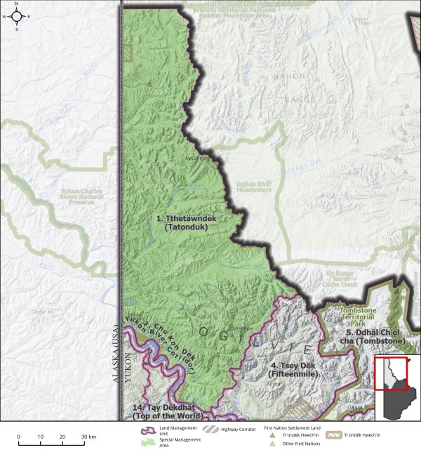
Land Use Designation: Special Management Area Land Status: Non-Settlement Land and Tr’ondëk Hwëch’in Settlement Land TH R-48A, TH R-4A, TH R-5A, TH R-76A, TH R-77B, TH S-133B1, TH S-134B1, TH S-6B1 Area: 7959 km2 Planning Region % 20% Walking on the Land Together...