“The purpose of a regional land use plan is to provide guidance for future land use and an indication of the desired future state of the region. This guidance may include the identification of varying degrees or types of land use in specific areas of the planning region, and should provide land use decision makers, assessors and land users with guidance and direction on the use of land, water and other renewable and non-renewable resources. By bringing clarity to the appropriate uses and levels of use of the land, a regional plan helps create certainty for land users and assists in avoiding future land use conflicts.”
~ Terms of Reference, Dawson Regional Planning Commission (2018)
Who We Are
The Dawson Regional Planning Commission was re-established in November 2018 under Chapter 11 of the Tr’ondëk Hwëch’in Final Agreement. It is an independent body with six Yukon community members, based on nominations received from the Parties (i.e., Government of Yukon and First Nations governments who have Traditional Territory within the planning region). The Parties for the Dawson plan are the Yukon and Tr’ondëk Hwëch’in governments. Na-Cho Nyak Dun First Nation and the Vuntut Gwitchin Government are not official Parties, but are observers as per their overlap agreements with Tr’ondëk Hwëch’in. Appointments are made by the Yukon Minister of Energy, Mines and Resources based on nominations received from each of the Parties. Parties nominate people who they think have the skills, knowledge and experience to assist in developing a successful land use plan.
Why We Were Created
Chapter 11 of the Umbrella Final Agreement (1993) envisioned a common land use planning process that would promote integrated management of land and resources. The objectives of Chapter 11, in part, are “to minimize… land use conflicts; to utilize the knowledge and experience of Yukon First Nations; and to ensure that social, cultural, economic and environmental policies are applied to the management, protection and use of land, water and resources in an integrated and coordinated manner so as to ensure Sustainable Development.”
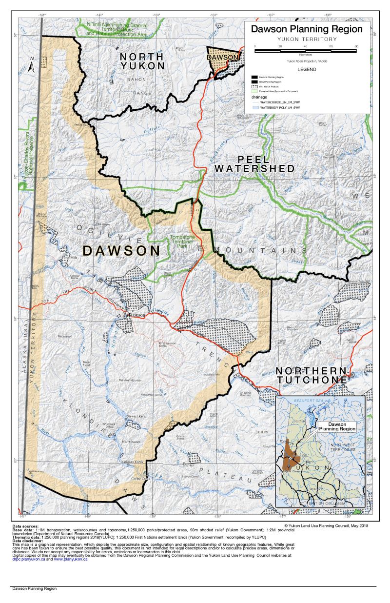
The Yukon was divided into planning regions, based mostly on First Nations Traditional Territories and watersheds. The governments of the Dawson Region agreed to establish a Regional Land Use Planning Commission.
Our History
A previous Commission operated from 2010 – 2014, when the approval of the Peel Watershed Regional Land Use Plan went to court. Now that that case has been resolved the two Parties have agreed to select a new Commission and to start planning again. Planning products and feedback from the first round will be available for the Commission to consider along side new or revised documents.
What We Do
A land use plan represents a vision for the future use and development of land in the region, and provides direction to governments on how to manage land and resources. The plan is not enacted through legislation, does not replace existing legislation, and does not affect First Nation rights established under land claim agreements and constitutional law. A land use plan tries to balance ecological, cultural and economic values of the region.
The Commission’s job is to develop and present a Recommended Land Use Plan, and if needed, a Final Recommended Plan for this area to the Parties, after which the Commission may dissolve. The Parties make the final decision on whether the plan is approved, modified, or rejected and the Parties are responsible for implementing the approved plan – Yukon government for public lands and First Nations for settlement lands.
The Commission cannot make recommendations about land that is within the City of Dawson municipal boundaries, land that is already managed under a Local Area Plan (e.g., West Dawson/Sunnydale), or existing protected areas (e.g., Tombstone Territorial Park). However, the Commission does consider these lands and any existing management plans when giving direction for the rest of the region.
Who Helps Us
The Commission is supported by one permanent staff member, operating out the Whitehorse office of the Yukon Land Use Planning Council, since October 2018.
The Parties have input throughout the planning process. Their technical staff work closely with Commission staff through the Technical Working Group (TWG). TWG helps to gather information on regional resources, reviews Commission products, and provides advice on government issues and policies that should be considered when developing plan options. The Parties are also represented by the Senior Liaison Committee (SLC), who provide the Commission with high-level policy advice and are the link between the Commission and the Ministers/Chiefs.
The Commission is also supported by the Yukon Land Use Planning Council (YLUPC). YLUPC was also created under Chapter 11 of the Umbrella Final Agreement, and is a three-person board with members nominated by Government of Yukon, Government of Canada and the Council of Yukon First Nations. YLUPC staff also helps by administering funding agreements, providing planning expertise and technical support, participating on the TWG, and helping Parties coordinate their efforts. For more information on YLUPC, visit their website www.planyukon.ca.
Who Funds the Commission
Money for the Commission to do its work comes from funds agreed to under the Umbrella Final Agreement. The funding is provided by the Government of Canada and administered by Government of Yukon. Government of Yukon reviews and approves annual Commission workplans and budgets.