|
Land Use Designation: |
Integrated Stewardship Area 4 |
||
|
Land Status: |
Non-Settlement Land and Tr’ondëk Hwëch’in Settlement Land TH R-2A and TH R-79B |
||
|
Area: |
466 km2 |
Planning Region % |
1.2% |
|
|
||||
|
Walking on the Land Together (Intent Statement) |
||||
|
The vision for this area is to conserve key habitat for woodland caribou while allowing for sustainable development. This area offers important habitat requirements for the Clear Creek caribou and Fortymile herds including habitat for calving, post-calving, summer, and rutting. This area also contains considerable mineral interests and development, and it has been identified as having high to significant mineral potential. Other activities in this area include active trapping and harvesting. Access into the LMU is relatively limited and there has been a long history of mining in the area. |
||||
|
Tr’ëhudè (Our Way of Life) & Stewardship |
||||
|
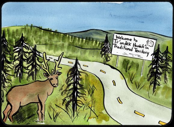
This LMU is the gateway to the Dawson Region. There is a sign that tells people who are driving on the Klondike Highway that they are entering the Traditional Territory of the Tr’ondëk Hwëch’in, for some it is a new experience, and for others it is a welcome home. There is overlap of Traditional Territory here with the First Nation of Na-Cho Nyäk Dun and they have identified the area as being an important place for fishing, traditional camps, and the Clear Creek caribou herd. DRPC Commission Members |
||||
|
Special Management Directions (Recommendations to achieve Vision) |
||||
|
In addition to all applicable General Management Directions, this area is subject to: 1. Industrial activities within caribou fall breeding (rut) habitat should be suspended during the key rutting period, (or as advised by a Regional Biologist) each year. 2. Any access development (roads and trails) within caribou fall breeding (rut) habitat should be avoided. 3. North Klondike Highway Corridor: Direction set out in Section 5.4.3.1.3 – North Klondike Highway Corridor (page 135) should apply. |
||||
|
Cumulative Effects Thresholds |
||||
|
Relative to LMU Size* |
Surface Disturbance (%) |
Linear Disturbance (km/km2) |
||
|
Current disturbance (2020) |
1.67 |
0.61 |
||
|
Precautionary |
1 |
0.5 |
||
|
Cautionary |
3 |
1.5 |
||
|
Critical |
4 |
2 |
||
|
On the ground amounts** |
Surface Disturbance (km2) |
Linear Disturbance (km) |
||
|
Current disturbance (2020) |
7.75 |
282 |
||
|
Room under cautionary threshold*** |
6.18 |
414 |
||
|
Precautionary |
4.64 |
232 |
||
|
Cautionary |
13.93 |
697 |
||
|
Critical |
18.58 |
929 |
||
|
*These are proportional to the size of the LMU, and correspond to table 3-2 of the Recommended Plan. They are measured in the % of the LMU that can be disturbed (“Surface Disturbance”) and in km/km2 (“Linear Disturbance Density”). **These are amounts that can be measured and apply to the whole LMU and would be more familiar to project proponents and regulators. They are measured in km2 of disturbance and in km of linear disturbance (e.g., roads, trails and cutlines). ***How much more disturbance can be added to existing disturbance before the cautionary threshold is reached. |
||||
Cumulative Effects Indicators
Surface Disturbance
Linear Disturbance
Precautionary |
Cautionary |
Critical |
These gauges show how much of each disturbance indicator there is in the LMU with the needle and the large number near the middle. The colours indicate disturbance level zones or “management thresholds”. If the needle is in the white zone, no threshold has been reached.
More information on our Cumulative Effects Framework is found here.

|
Priority Objectives |
|
|
ü People can access the land, water, and resources in a way that acknowledges and supports the values in each LMU and minimizes conflicts and cumulative effects. ü Placer and quartz mine exploration and development is carried out in a sustainable way and contributes to a growing diversified economy. ü Habitat and migration pathways are sufficient to support historic population levels of caribou. ü Healthy populations of migratory and non-migratory birds and raptors, including the preservation of flyways and other key habitat. |
|
|
Rationale for Designation |
|
|
· This area is located within important caribou herd ranges (Clear Creek) and moose habitat. · It is imperative to minimize disturbance to key (summer and winter) caribou habitat areas and to address impacts to moose through overharvesting while allowing for development. · Due to the area (km2) of the LMU and the existing surface disturbance and linear feature density, an ISA 4 designation allows for some additional development to occur in this LMU. |
|
|
Ecological Integrity and Conservation Value |
|
|
Birds |
Within the Tintina Trench Flyway, which offers an important migration route for migratory birds, there is some presence of high elevation (>1,000 m) habitat important for some migratory bird species. |
|
Caribou |
Overlap with Fortymile and Clear Creek caribou herd ranges. Contains key summer and winter habitat for mountain caribou, including habitat for calving, post-calving, summer, and rutting and key wildlife areas for the Clear Creek Caribou Herd. |
|
Ecosystem Representation |
|
|
Furbearers |
|
|
Grizzly Bear |
|
|
Landscape Connectivity |
Within the Tintina Trench Flyway. |
|
Moose |
Moose movement corridor. |
|
Salmon and other Fish |
|
|
Sheep |
Overlap with a wildlife key area for Thinhorn sheep. |
|
Species at Risk |
|
|
Vegetation and Unique Features |
Presence of some intact forest (>140 years old) and isolated occurrences of rare or endemic species. |
|
Water |
Contains Little South Klondike River channel and Left Clear Creek. |
|
Wetlands |
Some wetlands. |
|
Culture, Heritage Resources and Community Value |
|
|
Community Value |
Limited opportunities for recreation. |
|
Heritage Resources and Sites |
Several identified archeological sites clustered on the ridge above McQuesten, and along the Klondike Hwy on the north-east side of the LMU. |
|
Traditional Economy / Traditional Uses |
Area used for traditional economy activities especially harvesting, fishing, and gathering. Particularly in areas transected by the Klondike Highway and Clear Creek Road. Important areas for connecting to the land through the practice of land use/economic activities, including trapping, gathering, and harvesting. |
|
Socio-economic Value |
|
|
Agriculture |
Identified agricultural land disposition in the area along Clear Creek. |
|
Energy |
|
|
Forestry |
Overlap with the South Klondike River and Flat Creek landscape units of the Dawson Forest Resources Management Plan. No active timber harvest plans in the area. |
|
Mineral Resources |
Area contains active mineral exploration and development for both placer and hard rock interests and is of high mineral potential. |
|
Outfitting and Trapping |
Overlap with trapping concessions and one active outfitting concession. |
|
Tourism |
Limited opportunities for tourism, identified potential for horseback riding activities in the area. |
|
Transportation and Access |
Portion of LMU is adjacent to the North Klondike Highway and contains a secondary access road along Clear Creek and associated off roads. |