|
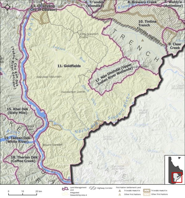
Land Use Designation: |
Integrated Stewardship Area 4 |
||
|
Land Status: |
Non-Settlement Land and Tr’ondëk Hwëch’in Settlement Land TH R-12A, TH R-18A, TH R-20A, TH R-46A, TH R-47A, TH R-58B, TH R-61A, TH R-62A, TH R-82A, TH S-18B1, TH S-93B |
||
|
Area: |
6,148 km2 |
Planning Region % |
15.4% |
|
|
||||
|
|
||||
|
Walking on the Land Together (Intent Statement) |
||||
|
The vision for this area will focus on sustainable development by means of cumulative effects management, access management, and the identification and preservation of key areas. The rich Tr’ondëk Hwëch’in cultural significance of this area should be enhanced and promoted. The mining industry remains a significant economic activity for the Region, and the Dawson Placer Mining District is by far the most productive placer mining district in the territory. This area also offers ample opportunity for hunting, harvesting, gathering, and contains areas of ecological, historical, and cultural significance and offers high tourism, forestry, and recreational value. The people in the Dawson community have a very close connection with this area in many ways. |
||||
|
Tr’ëhudè (Our Way of Life) & Stewardship |
||||
|
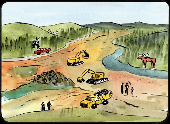
The gold rush that began in the late 1890s brought enormous changes to the Tr’ondëk Hwëch’in way of life and the search for gold continues to this day in the Goldfields. While this area is known to the outside world as an active gold mining landscape, more importantly it is where Tr’ondëk Hwëch’in have travelled, gathered, and harvested for generations. It is a place of recreation, community, and harvest. This area is strongly connected to Chu Kon Dëk (the Yukon River) which makes it culturally important. |
||||
|
Special Management Directions (Recommendations to achieve Vision) |
||||
|
In addition to all applicable General Management Directions, this area is subject to: 1. Opportunities to promote awareness of Tr’ondëk Hwëch’in cultural history and contemporary land use in this area should be explored. 2. This area contains important habitat for sharp-tailed grouse, which are a species of immediate management concern. Development in this area should be planned to minimize impacts to key habitat for sharp-tailed grouse. 3. Contains the highest concentration of historic sites (outside of the City of Dawson) within the Planning Region, including the Ridge Road Heritage Trail, Discovery Claim, and Dredge #4 which represents significant tourism and recreational potential. Efforts to enhance the recreational aspects of this area should be explored. 4. This LMU is listed in Section 5.4.3 – Transportation and Access (page 129), as being a priority area for an access management plan. The proposed Northern Access Route modifications and extension will likely have a significant impact to this LMU and its values. |
||||
|
Cumulative Effects Thresholds |
||||
|
Relative to LMU Size* |
Surface Disturbance (%) |
Linear Disturbance (km/km2) |
||
|
Current disturbance (2020) |
2.34 |
0.76 |
||
|
Precautionary |
1 |
0.5 |
||
|
Cautionary |
3 |
1.5 |
||
|
Critical |
4 |
2 |
||
|
On the ground amounts** |
Surface Disturbance (km2) |
Linear Disturbance (km) |
||
|
Current disturbance (2020) |
143.9 |
4684 |
||
|
Room under cautionary threshold*** |
40.3 |
4521 |
||
|
Precautionary |
61.37 |
3068 |
||
|
Cautionary |
184.10 |
9205 |
||
|
Critical |
245.46 |
12273 |
||
|
*These are proportional to the size of the LMU, and correspond to table 3-2 of the Recommended Plan. They are measured in the % of the LMU that can be disturbed (“Surface Disturbance”) and in km/km2 (“Linear Disturbance Density”). **These are amounts that can be measured and apply to the whole LMU and would be more familiar to project proponents and regulators. They are measured in km2 of disturbance and in km of linear disturbance (e.g., roads, trails and cutlines). ***How much more disturbance can be added to existing disturbance before the cautionary threshold is reached. |
||||
Cumulative Effects Indicators
Surface Disturbance
Linear Disturbance
Precautionary |
Cautionary |
Critical |
These gauges show how much of each disturbance indicator there is in the LMU with the needle and the large number near the middle. The colours indicate disturbance level zones or “management thresholds”. If the needle is in the white zone, no threshold has been reached.
More information on our Cumulative Effects Framework is found here.

|
Priority Objectives |
|
|
ü Mineral exploration and development contribute to local employment, economic stimulus, and long-term socio-economic benefits. ü People can access the land, water, and resources in a way that acknowledges and supports the values in each LMU and minimizes conflicts and cumulative effects. ü Traditional land use activities. ü New trails and/or the revival of historic trails in a manner consistent with stewardship and sustainability. ü Tourism and recreational experiences include scenic viewscapes, wildlife viewing, culture appreciation, and heritage education within appropriate areas of the Planning Region. ü Increased opportunities for tourism experiences contribute to a growing diversified economy, local employment, and economic stimulus. ü A diverse range of sustainable recreational opportunities in the Region. ü Opportunity for sustainable forestry that contributes to a growing diversified economy, local employment, and economic stimulus. |
|
|
Rationale for Designation |
|
|
· Area should remain open for mineral exploration and development, which is a significant contributor to the Region’s economic and socio-cultural environment. · This area is particularly important for subsistence and licensed harvesting (moose) and the pursuit of traditional economic activities. The ability for residents to continue using the land in this way must be maintained. · General management directions and the special management directions above should ensure adequate protection of wildlife habitat and that the multi-industrial nature of this area can co-exist with recreational and traditional pursuits. · Taking into consideration the current level of activity as well as continued growth and importance of the area for industry warrants a high threshold for development, i.e., an ISA 4 designation. |
|
|
Ecological Integrity and Conservation Value |
|
|
Birds |
Key areas for sharp-tailed grouse and raptors, and within the general range of migratory birds. |
|
Caribou |
Area overlaps with the Fortymile Caribou Herd ranges, and there are important ridgetop migration routes and overwintering habitat within this area. |
|
Ecosystem Representation |
|
|
Furbearers |
Watercourses of good to excellent quality for stream dwelling beaver habitat suitability, and key habitat areas for beaver. Low to moderate habitat suitability for muskrat. |
|
Grizzly Bear |
|
|
Landscape Connectivity |
|
|
Moose |
Considered extensive good moose habitat, and important grounds for moose harvesting. |
|
Salmon and other Fish |
Important habitat for salmon migration/spawning and freshwater fish. Contains several known resident fish bearing streams and rivers. |
|
Sheep |
|
|
Species at Risk |
|
|
Vegetation and Unique Features |
Presence of some scattered occurrences of intact forest (>140 years old). |
|
Water |
Large area with numerous watersheds. Major watercourses and tributaries include Hunker, Bonanza, Dominion, and Sulphur Creeks, as well as the Indian and Stewart Rivers and various smaller streams that enter the Yukon River. |
|
Wetlands |
Wetlands prevalent along Indian River and Stewart River. |
|
Culture, Heritage Resources and Community Value |
|
|
Community Value |
Presence of a well travelled route (Hunker-Bonanza Loop) for recreational pursuits, as well as hiking and biking, especially along the Ridge Road Heritage Trail. The area is of high community importance for recreation, harvesting, and working. |
|
Heritage Resources and Sites |
High volume of historic sites and resources within this area related to Klondike Gold Rush history. Several National Historic Sites in this area including the Discovery Claim and Dredge No. 4. Significant area for paleontological resources in particular given the nature of disturbance in the area as well as archaeological sites and recorded historic resources. |
|
Traditional Economy / Traditional Uses |
Important areas for connecting to the land through the practice of land use/economic activities, including trapping, gathering, and harvesting. Ensuring wetland habitat remains intact has been noted as an important stewardship duty for Tr’ondëk Hwëch’in. |
|
Socio-economic Value |
|
|
Agriculture |
Potential for growth in areas of high suitability for agriculture, including suitable soil conditions close to the City of Dawson, as well as areas for grazing and farm related infrastructure. |
|
Energy |
|
|
Forestry |
Goldfields is a landscape unit of high priority for planning in the short-term under the Dawson Forest Resources Management Plan. Active Timber Harvest Plans include Dominion, French Gulch, Bonanza I, Bonanza II, Mummie Pup, and Flat Creek, and there are areas of personal and commercial fuel use. Several associated access roads attributed to forest resources in the area. |
|
Mineral Resources |
Area of significant value for mineral resources for both placer and hard rock mining. Presence of numerous active mineral tenure and permits and associated infrastructure, including roads, drill pads, staging areas, camps, cutlines, helicopter pads, airstrips etc. |
|
Outfitting and Trapping |
Active trapping concessions and associated infrastructure, including trapping routes and cabins. |
|
Tourism |
High tourism value in areas related to Klondike Gold Rush history and contemporary mining, including television programs on placer mining. |
|
Transportation and Access |
Significant transportation route offered by Hunker-Bonanza loop and off roads. |