Oct 25, 2022
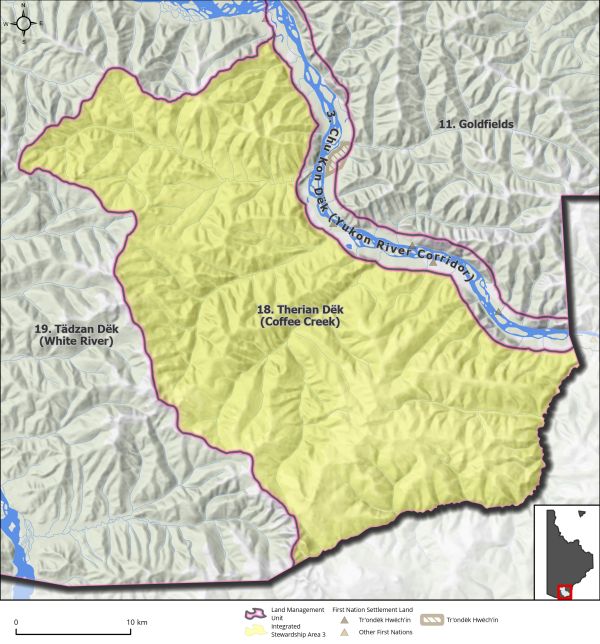
Land Use Designation: Integrated Stewardship Area 3 Land Status: Non-Settlement Land Area: 998 km2 Planning Region % 2.5% Walking on the Land Together (Intent Statement) The vision for this area will focus on sustainable development by means of cumulative...
Oct 25, 2022
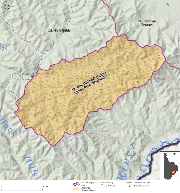
Land Use Designation: Integrated Stewardship Area 2 Land Status: Non-Settlement Land Area: 485 km2 Planning Region % 1.2% Walking on the Land Together (Intent Statement) The intent for this area is to limit the scale of development within the upper drainage of the...
Oct 25, 2022
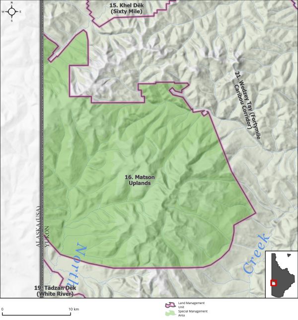
Land Use Designation: Special Management Area Land Status: Non-Settlement Land Area: 708 km2 Planning Region % 1.8% Walking on the Land Together (Intent Statement) The intent for this area is the preservation of core summer habitat required for the continued...
Oct 25, 2022
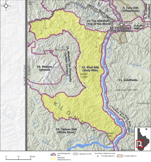
Land Use Designation: Integrated Stewardship Area 3 Land Status: Non-Settlement Land and Tr’ondëk Hwëch’in Settlement Land TH R-11A, TH R-43A, TH S-107B1, TH S-14B1, TH S-169B1, TH S-75B1 Area: 2897 km2 Planning Region % 7.3% Walking on the Land Together (Intent...
Oct 25, 2022
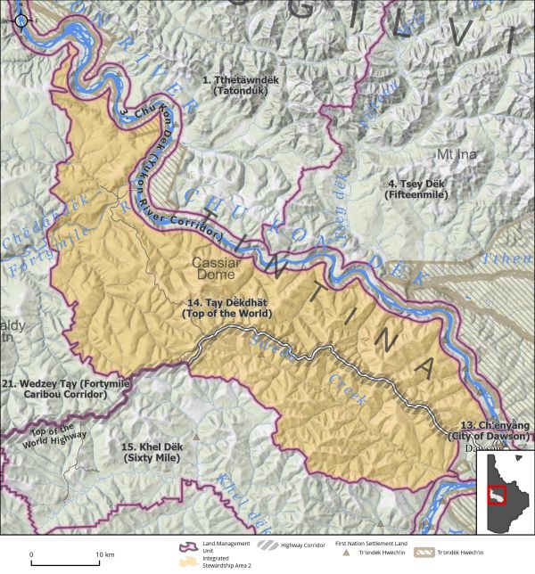
Land Use Designation: Integrated Stewardship Area 2 Land Status: Non-Settlement Land and Tr’ondëk Hwëch’in Settlement Land Parcels TH S-90B1, TH S186B1, TH S-12B1, TH R-23A, TH R-9A, TH R-71A, TH R-24A, TH R125A Area: 1,574 km2 Planning Region % 3.9% Walking on...


