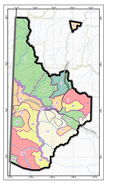
As much as possible, the boundaries of each LMU follow an existing natural (e.g., watershed, major river), or man-made (e.g., highway, Tr’ondëk Hwëch’in land selections) boundary. Where applicable, LMU boundaries have been delineated to be consistent with adjacent Regional land use plans.
The Plan recommends establishing 21 LMUs within the Dawson Planning Region (see our Interactive Map or the downloadable Map 1 – Land Designations). The management intent for each LMU has been included in Section 6 – Landscape Management Units (page 160 of the full Recommended Plan) including the recommended land use designation and any special management directions recommended. This information, and more, will soon be included on our Interactive Map and the pages below.
| LMU 1 | LMU 8 | LMU 15 |
| LMU 2 | LMU 9 | LMU 16 |
| LMU 3 | LMU 10 | LMU 17 |
| LMU 4 | LMU 11 | LMU 18 |
| LMU 5 | LMU 12 | LMU 19 |
| LMU 6 | LMU 13 | LMU 20 |
| LMU 7 | LMU 14 | LMU 21 |

