Since our Recommended Plan went public, we recognized that it is a large document and wanted to make parts of the plan more accessible and easy to find. We are trying to do this by creating a series of new web-pages that try to better explain some core concepts. All the information on these pages were taken from the documents we posted here, though in some cases text was rewritten for clarity or information was analyzed to better show patterns and relationships.
This work may set the stage for a separate, user-friendly version of the plan. It also demonstrates some ideas for a future website that helps assessors and project proponents use the plan. Proponents could use guidance on that website to refine their proposals before submitting them to YESAB.
These pages include:
Cumulative Effects Framework
This page introduces, explains and gives examples for key concepts in the plan’s cumulative effects framework, including:
- Indicators
- Surface disturbance
- Linear feature density
- Reclamation and recovery
- Thresholds
- Scenarios
It then integrates findings from the Commission’s cumulative effects report to show how close each LMU is to their thresholds. It ends by describing regional patterns in future scenarios.
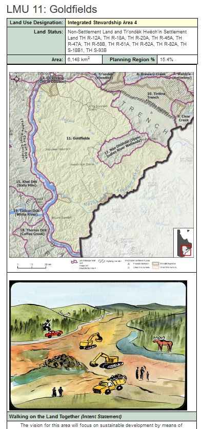
Land Management Units
The Recommended Plan divides the Dawson Planning Region into discrete areas of land called Landscape Management Units (LMUs). This page describes their role in the plan before providing links to information pages for each LMU. These include not only all the information provided in Section 6 of the plan, but also illustrations from the illustrated summary and information on the cumulative effects indicators. The cumulative effects information includes the thresholds, the current amounts of each indicator (as of 2020) and the “room under the cautionary threshold” – or how much more disturbance can be added to existing disturbance before the cautionary threshold is reached.
Interactive Map
This interactive map allows visitors to pan, zoom and click their way through the Dawson Region. Currently there are only 2 layers available: LMUs with their designations and the highway corridor zone. We are hoping to add more in the future.
The fun begins when you click on an LMU: a pop-up box opens with information on the LMU’s name, size, zoning, as well as an illustration and a link to that LMU’s information page described above.