5.3.7 Wetlands
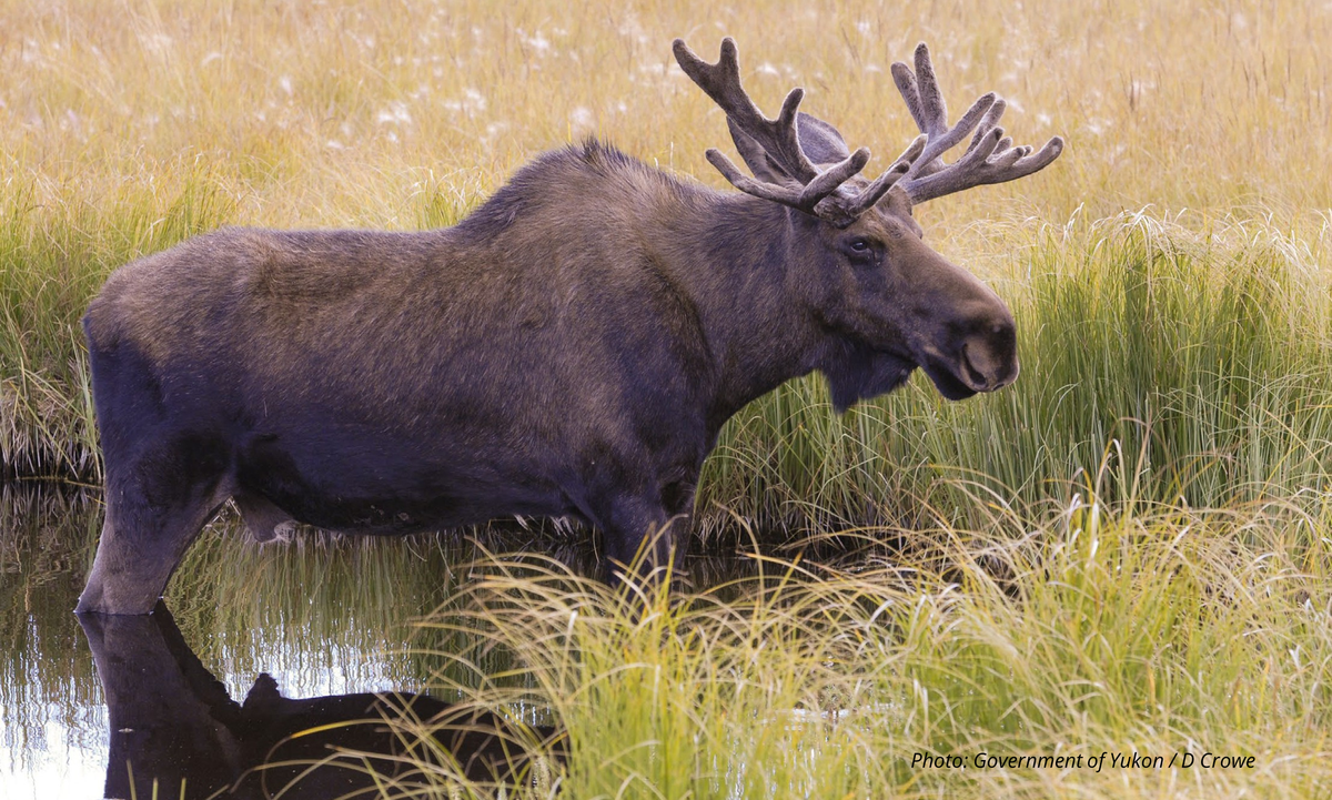
Wetlands are areas that typically have water at or near the ground surface during some or all of the year. An area is considered a wetland when water remains long enough for poorly drained soil to form, and for water-loving plants to become the dominant vegetation. Wetlands cover about 10 to 12% of the Region and are often sites of land-use conflict because of their socio-cultural and environmental importance overlaps with a high potential for placer mining.
Wetlands support wildlife and fish communities and, for the Tr’ondëk Hwëch’in, are places of immense historic and cultural value where subsistence harvest and cultural connection can occur. There are numerous benefits that wetlands provide, including fish and wildlife habitat, water storage and regulation, carbon storage, erosion control, regulation of water flow, and flood mitigation.
Impacts on these wetland values have downstream repercussions and risk negatively affecting interrelated environmental and social systems. Because wetlands are interconnected with the rest of the landscape, activities upstream of and adjacent to them also affect wetland health. When they are not altered, disturbed, or thawed, wetlands are a globally significant carbon reservoir. Wetland disruptions and thawing of permafrost releases greenhouse gases such as methane and carbon dioxide, which further contribute to climate change.
There are five wetland classes in the Yukon: bogs, fens, swamps, marshes, and shallow open water. Their form and function are shaped by topography, hydrology, and soil conditions. Bogs typically occur in flat, poorly drained upland areas where precipitation exceeds evaporation, leading to the accumulation of peat and acidic conditions. Fens, in contrast, are found in low-lying areas with continuous groundwater flow, resulting in more nutrient-rich and less acidic environments that support a diverse array of plant species. Swamps are generally located in forested lowlands or along river margins, where standing or slow-moving water supports woody vegetation and dynamic ecological processes. Bogs, fens, and some swamps are characterized by having peat, an accumulation of partially decayed vegetation or organic matter that takes a very long time to form and is difficult, if not impossible, to restore once it is disturbed.
Marshes are wetlands dominated by plants such as grasses and sedges, while shallow open water wetlands are areas with standing water less than two metres deep that typically supporting aquatic vegetation. These wetland types are generally easy to identify on the ground.
Tr’ondëk Hwëch’in and Ducks Unlimited Canada have completed a watershed-level wetland classification mapping project in the Region. Ongoing work will produce further wetland mapping for the Region, which should help identify the extent, location, and classification of the Region’s wetlands.
The overlap between wetlands and mineral interests is largely a function of topography and geological history. Many wetlands are situated in valley bottoms, floodplains, and low-lying basins. These areas also tend to concentrate mineral deposits due to sedimentary processes and glacial activity. They often contain gold and other valuable minerals, which makes them attractive for exploration and development.
However, the ecological sensitivity of wetlands, combined with their cultural and subsistence importance to local communities and the ecosystem services they offer, creates a complex challenge for land use planning. In areas where wetlands and mineral interests overlap, the local placer industry is encouraged to take a measured approach and to protect cultural and ecological values. Under existing standards, completed wetland reclamation generally does not restore the original class and function.
The current regulatory system and reporting requirements do not provide enough protection for the cultural and ecological values of wetlands. Continued improvement will be necessary to reach an acceptable level of protection. This includes successor legislation, enhancements to the Government of Yukon’s Policy for the Stewardship of Yukon’s Wetlands (hereafter Wetlands Policy), advancement of the cumulative effects framework, creation of a publicly available wetland inventory, and development of a reporting and monitoring system.
While the Wetlands Policy is intended to guide wetland management across the Yukon, it should only supersede the Plan’s Stewardship Directions if it meets or exceeds them. Effective wetland management in the Region must be guided by the best available information, including evolving data on wetland location, functions and benefits, cultural importance and traditional use, climate change impacts, and reclamation effectiveness. As ecosystems respond to climate change, wetland characteristics are also likely to shift over time, reinforcing the need for adaptive and informed policy tools.
Mitigation Hierarchy
Because wetlands are ecologically sensitive and culturally significant, and because we know relatively little about how to restore them, the mitigation hierarchy must be applied rigorously to all development activities that intersect with wetlands. This approach provides a structured framework to reduce impacts and uphold stewardship responsibilities.
- Avoidance is the most effective way to protect wetland values and should be prioritized wherever possible. The overlap between placer mining potential and wetland distribution is extensive, particularly in valley bottoms and low-lying basins. High-resolution imagery and detailed wetland mapping are essential tools for identifying wetlands and setting clear avoidance targets. These targets could include thresholds for the percentage of wetland area to be left undisturbed within a watershed or sub-region, especially for peat-forming wetlands like bogs and fens that are difficult or impossible to restore.
- Land users should employ minimization strategies when avoidance is not feasible. High-resolution imagery and site-specific data are critical for designing operations that reduce the spatial footprint and hydrological disruption of wetlands. Techniques may include seasonal timing of activities, sediment control measures, and buffer zones to protect adjacent wetland functions.
- Land users must follow the values-based reclamation framework (Section 3.11), which emphasizes values-based outcomes.
- Offsetting is the final step when original wetland benefits cannot be fully restored. It may involve restoring historic mining disturbances elsewhere in the Region. While offsetting to alternate wetland outcomes may provide some ecological benefit, it must be carefully weighed against the loss of original wetland functions, especially cultural and subsistence values. Offset projects should be designed to complement regional conservation goals, and these projects should be subject to public reporting and review.
Wetlands of Special Importance
Through the Wetlands Policy, wetlands with unique ecological characteristics, cultural significance, or important benefits may be designated as Wetlands of Special Importance (WSI). The Government of Yukon has committed to ensuring “no loss or reduction of wetland benefits” in these areas. However, WSI designation does not automatically prohibit land disposition, mineral staking, exploration, or mining. To receive new authorization in a WSI, proponents must demonstrate during the assessment process how their project will maintain wetland benefits.
The Plan nominates four wetland complexes in the Region for Wetlands of Special Importance status (Figure 13). A wetland may be designated as a WSI if it meets one or more of the 10 established criteria. Each wetland complex serves as a critical carbon reservoir, making it eligible for designation on that basis alone. In addition, all four wetland complexes are likely to be considered an intact representative wetland in watersheds where further alteration or loss will cross an accepted ecological or management threshold, (per the Wetlands Policy). Pending input from Tr’ondëk Hwëch’in, the Government of Yukon may also consider each wetland complex to be considered of significant social or cultural importance. Further criteria may also be met as more data are collected.
While the WSI designation will provide some protection to the listed wetlands, and the Wetlands Policy encourages protective best practices, together they still fall short of the level of protection wetlands warrant across the Region for their cultural and ecological significance. This Plan therefore requires additional measures to protect wetlands in the form of the Stewardship Directions below, as well as recommendations to the Parties to strengthen their respective policies.
Key Planning Issues
- Wetland complexes hold high cultural and traditional value. When human activity alters wetlands, people may use the area less for harvesting, recreation, traditional pursuits, and stewardship, which reduces their connection to the land.
- When Tr’ondëk Hwëch’in Citizens cannot carry out their stewardship responsibilities to the land, both the land and people are negatively affected.
- Wetlands are vulnerable to the effects of climate change. Human activities may worsen these vulnerabilities.
- Industrial development can harm wetlands directly by destroying wetland areas and indirectly by increasing access, causing contamination, and changing water regimes.
- The Parties do not yet fully understand the extent and types of wetlands across the Region.
- Areas of high potential mineral value and high ecological and cultural value often overlap in wetland complexes in the Region.
Goals
- Functioning wetland ecosystems persist across the Region and support wetland benefits and ecological and socio-cultural values.
- Impacts from human activities and development do not significantly affect regional hydrology.
Stewardship Directions
- Treat wetlands with humility and respect, and recognize your role as a caretaker rather than an owner.
- Rigorously apply the mitigation hierarchy when proposing development projects in or next to wetlands. Avoiding development in wetlands is always the preferred outcome.
- All development proposals should state whether the project overlaps with wetlands1. Where a proposed project overlaps with wetlands, proponents should submit:
- A map that identifies the location and type of wetlands using the best available data and following established mapping standards.
- A wetland mitigation plan that outlines how the project follows the steps of the mitigation hierarchy.
- A wetland reclamation plan for approval before work begins.
- Minimize fragmentation of wetlands.
- Limit water withdrawals and flow diversions upstream of wetlands.
- The following wetlands require additional protection:
- Undisturbed2 bogs and marshes throughout the Region.
- Undisturbed2 fens in Special Management Areas.
- Undisturbed2 fens in Wetlands of Special Importance.
For new projects or renewals under YESAB review, proponents will be provided with the location of these wetlands. For existing projects, proponents should make best efforts to identify them.
- Do not carry out any activity or development in these wetlands, or within a buffer from the edge of the wetland:
- 5 m for wetlands ≤1 ha.
- 60 m for wetlands >1 ha.
- Only carry out activities that do not harm the integrity of the wetland and its buffer within a further:
- 60 m for wetlands ≤5 ha.
- 140 m for wetlands >5 ha.
These buffers apply until further evidence suggests more accurate buffer sizes.
- Support and increase stewardship and appreciation of wetlands. Some possible approaches include hosting and participating in land-based cultural activities. You can also explore opportunities to share and learn about the ecological and cultural roles of different wetland types.
1 Wetlands in the Region have been fully mapped, but the data are not publicly available in full at this time. However, YESAB provides wetland mapping on a project-by-project basis during its review process.
2 No disturbance from human activity resulting in linear feature density or surface disturbance.
Implementation Actions
- Monitor, report, and annually tabulate the disturbance of wetlands at the scale of LMUs.
- The Region would benefit from the development of a Wetland Suitability and Development Index – a project-scale tool designed to identify areas with high wetland suitability and guide decisions about development based on that suitability. Similar in approach to the FHMS, this regionally specific Index would enable fine-scale predictive wetland mapping across the Region by providing the analytical framework and inputs needed to model wetland presence, extent, and sensitivity. Possible data inputs for identifying suitability include: LiDAR, soils data, hydrology, vegetation layers, and local or Indigenous knowledge. This Index would support the maintenance of wetland benefits and functions, inform project proposals and assessments, and fill key gaps left by the territory-wide Wetlands Policy by offering operational guidance at a finer scale relevant to on-the-ground decision-making.
- Ensure that wetland classification mapping and hydrological models are completed and shared to support the implementation of wetland disturbance thresholds. These should be completed using a scale that works for on the ground implementation of the Plan. The Parties can expand on mapping already completed by Ducks Unlimited Canada and Tr’ondëk Hwëch’in. They should prioritize detailed wetland inventories in areas with concentrations of wetlands and development interest – for example, LMU 17 : Nän Dhòhdäl (Upper Indian River Wetlands), and these should be made publicly available for use by regulators and proponents.
- Promote biocultural and climate monitoring of wetlands that incorporates traditional and land-based knowledge.
- Promote and support land-based cultural activities in wetland areas.
- Recognize the role of wetland conservation in building climate resilience and promote wetland reclamation strategies that sequester carbon.
- Encourage and, where possible, help to complete the Yukon Water Board Wetland Plan Guidelines (recognizing that completion is the responsibility of the Yukon Water Board, not the Parties).
- Promote appreciation for wetlands through public education, focusing on understanding the values and functions of wetlands with the goal of and creating stewardship opportunities that deepen local connection to wetlands.
- Apply an adaptive approach to wetland buffers. The purpose of buffers is to protect wetland functions and benefits in areas where development is allowed. Recognizing that the recommended buffer may not be sufficient to protect certain wetland functions or benefits, use this approach to increase the recommended buffer when site-specific assessment or research is conducted. Increase buffers when the Parties agree on revised buffer widths. The Parties should consider the best available data and literature on wetland buffers to determine a solution based on the characteristics of the watershed, wetland type, and the intensity of associated land activities.
- Offer workshops, training, or guidance documents to help proponents recognize wetland features and identify wetland classes in the field.
- As part of fulfilling stewardship responsibilities to wetlands, encourage stewardship by industrial and commercial operators and make necessary information available. Require the rigorous application of the mitigation hierarchy in proposals and operations, with a focus on avoiding negative impacts. Further, ensure compliance with buffer-related wetland Stewardship Directions.
Per Implementation Action 1, start work on cumulative effects indicators and related elements for this value by the end of year two.
Governance Recommendations
- Provide full and permanent legal protection for WSIs, either under an existing mechanism or a new one as required. Apply full interim protection as soon as areas are nominated. (Government of Yukon)
- Ensure compliance with water licenses, land use permits, and wetland policy requirements.
Knowledge Gaps
- Knowledge of effective wetland reclamation strategies to restore wetland functions is incomplete.
- Knowledge of how climate change affects wetlands is incomplete and limits policy decisions.
- There is limited information on how wetlands resist and recover from human disturbance and to increasing climate pressures.
- There is limited information on measurable indicators of wetland health.
- More accurate estimates of carbon emissions from wetlands are required.
- Research should establish scientifically validated buffer distances and requirements (for example, acceptable activities) for wetlands to protect wetland values. These distances and requirements should reflect ecological conditions, hydrological connectivity, and species habitat requirements.